Ceramic Patch Antennae Solutions
Compact, high gain, capable of supporting wide range of GNSS frequencies and a variety of PCB designs.
Compact, high gain, capable of supporting wide range of GNSS frequencies and a variety of PCB designs.
Materials used:
Alumina, ALN, Zirconia, LTCC and HTCC multilayer substrates,
Process:
MLC, Bulk Process Plating, Thin Film
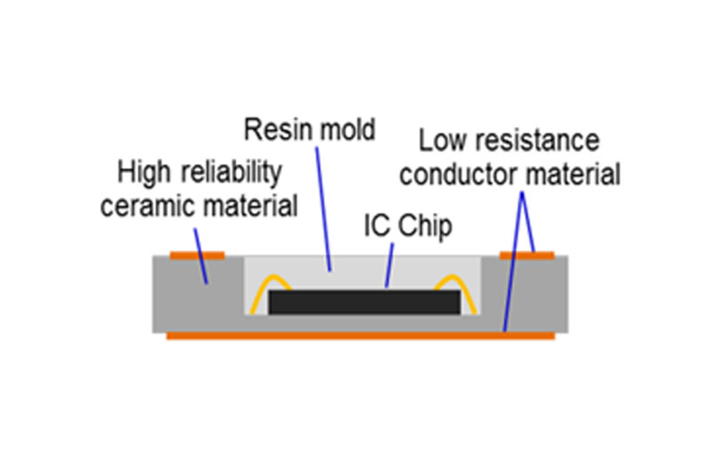
Products:
RF Antennae Modules, Military Power Modules and X-ray detector sub.


Automobiles can be equipped with GNSS receivers at the factory or as aftermarket equipment. Further the emergence of driverless vehicles, autonomous delivery drones etc. are also driving the need for high centimetric accuracy GNSS solutions.
Air navigation systems usually have a moving map display and are often connected to the autopilot for en-route navigation. Cock-pit mounted GNSS receivers are appearing in general aviation aircraft of all sizes, allowing use in final approach and even landing operations.
Heavy equipment can use GNSS in construction, mining, and precision agriculture.
Cyclists, hikers, climbers and even pedestrians can use GNSS to determine their position. In isolated areas, the ability of GNSS to provide a precise location can greatly enhance the chances of rescue in emergency situations.
Military precision guided munitions
Precise time-reference- Many systems that must be accurately synchronized use GNSS as a source of accurate time. TDMA communication networks often rely on this precise timing to synchronize RF generating equipment, network equipment and multiplexers.
The first Global Navigation systems were developed in the 20th century, mainly to help military personnel find their way. But location awareness soon found many civilian applications as illustrated.
Global Navigation Satellite System (GNSS) receivers use GNSS frequencies from the following satellites:

The Ceramic Antennae which we offer are manufactured with state of the art technology and are equipped with the following characteristics:


Let's talk