Geo Data Solutions
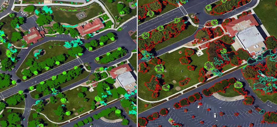
3D and 4D vectors, Clutter Heights, Clutter Classes, Orthoimagery, Terrain Data
3D and 4D vectors, Clutter Heights, Clutter Classes, Orthoimagery, Terrain Data
The operators need accurate geo-data to improve their existing networks and plan for future network rollouts.
The Internet of Things (IOT), upcoming 5G rollouts, and the almost insatiable demand of mobile subscribers for video content requires densification of existing networks and a robust future-proof network planning, thereby increasing the demand for accurate, high-resolution geodata.
The 3G/4G/LTE and the upcoming 5G rollouts present an immense opportunity as well a huge challenge to operators and managed Services providers. If you have to remain competitive you have to roll out fast and not overshoot the rollout budget.
As telecom veterans we know that by default the first step which an engineer takes when a site is handed over to him for implementation is open google earth and check the coordinates for access roads, obstructions around the site and other site environment. Since the google data is always very basic and raw, the project team has no other option but to send a full fledged site survey team even for the initial and basic physical site inspection. This process has to be repeated for hundreds of sites in remote areas, which means multiple cabs, manhour and monies loss. Further for network planning the teams need to conduct exhaustive site visits for L.O.S. and RF drive tests, without really getting an accurate birds’ view of the environment around the site, which is vital for provisioning for MW and RF interference and link budgeting. A reliable, accurate and high resolution geo data solution, which can effectively align with the RF and MW planning tools, will facilitate faster and efficient rollouts and also aid CA (Cost Avoidance), an important performance metric for the telecom sourcing and project teams.
The application of Geo-data solutions is not only limited to wireless rollouts only. Even the OSP works, fixed backhaul, FTTx rollouts, etc. involves expensive and detailed route planning and physical on-site surveys; which can altogether be avoided by our high resolution Geo Data solutions.
Our Geo data solutions will transform the way rollouts, network planning and operations and maintenance activities are done and will bring for you huge $$$$ savings.
Our Geo-Data solutions allows you to plan for large scale networks with optimal performance and act on your industry’s rapid changes while keeping down costs. We offer you a cost effective next gen solutions.


Data for Real-World simulation and comprehensive planning precisely designed for next-generation networks


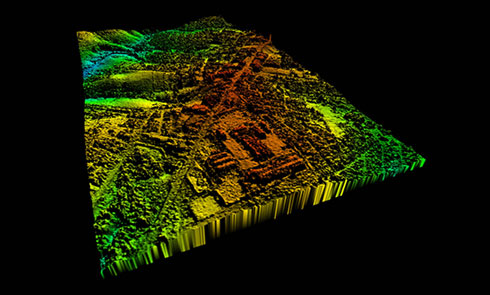
Geo-data for Wireless network design, 2D, 2.5D, 3D models (orthoimage, linear objects, building and vegetation, population, terrain, surface, etc.)
Let's talk